Location intelligence
Enter the address. The location pages research themselves.
OfferingStack pulls drive times, amenities, transit, traffic counts and the local labour pool for the property, draws them on print-ready maps and prints the source and date under every figure.
What gets pulled
Seven sources, all of them named.
Each section below appears in the brochure or OM only when its source returns data for your address.
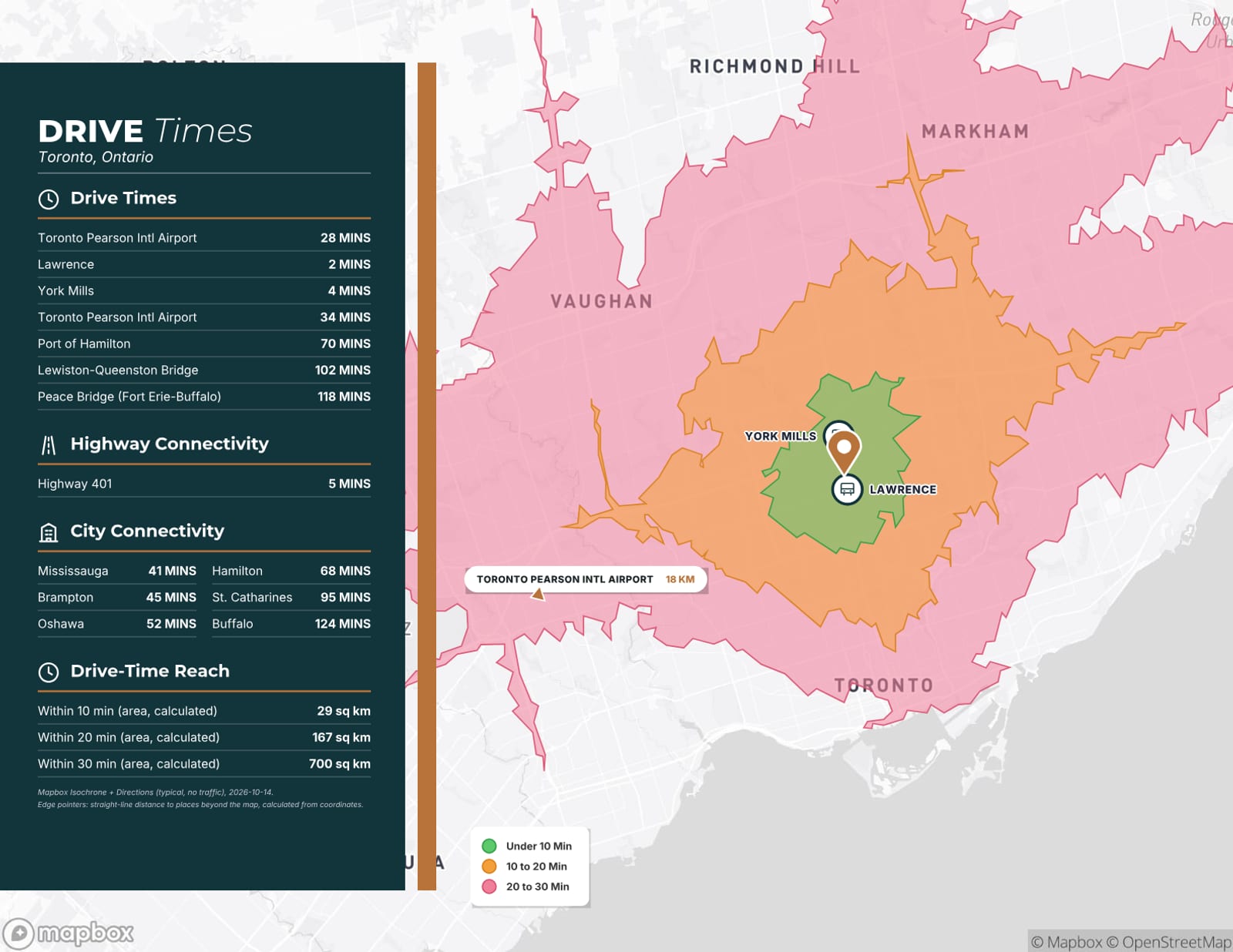
Drive-time areas
10, 20 and 30-minute drive areas fitted around the property and drawn on the map.
Mapbox Isochrone API
Source and retrieval date printed under the map.
Connectivity tables
Drive times and distances to the airports, rail, ports, border crossings, highways and cities that matter for the asset type.
Mapbox Directions Matrix
Each table carries its source and date.
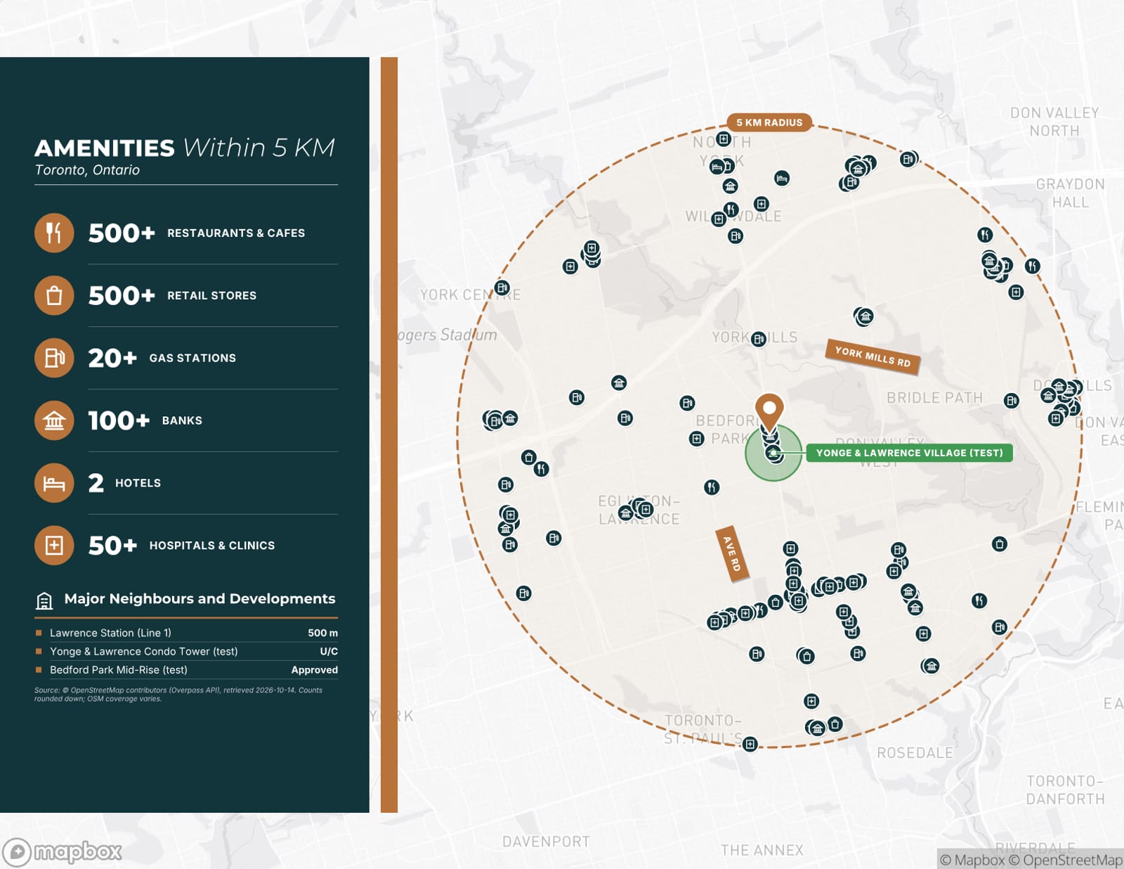
Amenities
Restaurants, groceries, banks, fitness, hotels and other everyday services within 3, 5 and 10 km.
OpenStreetMap contributors (Overpass API)
Counts are rounded down, never up, and dated.
Transit
Nearby stations and stops with walking times, and rapid-transit lines on the map for walkable properties.
OpenStreetMap contributors; Mapbox walking routes
Walk times are routed, not straight-line guesses.
Traffic counts
Average daily traffic on the roads beside the property, with the count year.
Ontario provincial highway counts; Peel, Brampton and Toronto municipal counts; US federal highway data
Count year and publisher shown with every figure.
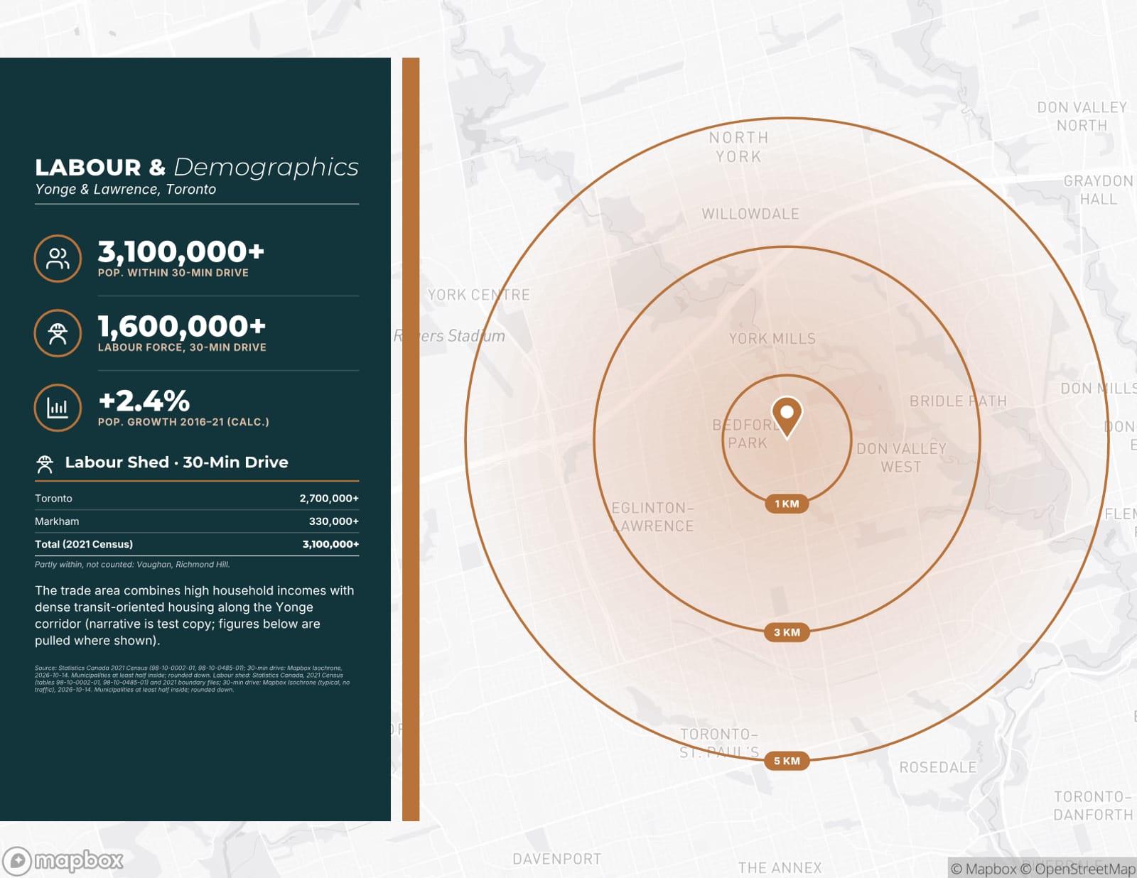
Labour shed
Population of the communities within a 30-minute drive of the property.
Statistics Canada, 2021 Census of Population
Census year and boundary method stated on the page.
Neighbouring occupiers
Major businesses and retail anchors near the site, listed and placed on the map.
OpenStreetMap contributors; logos from Wikidata where they match
A logo appears only when the brand match is confirmed.
Rules it follows
Sourced, dated, never guessed.
- Real data only. If a source is down or has nothing for the address, that section is left out with a note to you. Nothing is estimated to fill the gap.
- “Why this location” bullets are written only from the figures pulled for your property, each one keeping its source and date.
- Move the pin or change the address and the old location sections are cleared, so a brochure never describes the wrong place. “Refresh location data” pulls them again.
- Points more than 25 km away are left off the map with a warning instead of stretching the map to fit them.
From the sample brochure
Real pages, unedited.
These pages were generated by OfferingStack, unedited, for a fictitious sample listing (3256 Yonge Street, Toronto). The address is used only to pull real location data; the listing, brands and any figure marked (test) are not real.
See the location pages for your own listing.
Start from an address. You’ll see a watermarked preview of your own document before you pay for anything.