CRE marketing guide
What to include in an industrial land brochure
The pages, facts and maps an industrial land brochure needs: site, zoning, servicing, access, labour and neighbours, and how to present each one.
Why land brochures are different
A building can be toured; a vacant site mostly cannot. Buyers of industrial land, whether developers, owner-users or investors, are buying what the land allows them to build and how well it connects to highways, labour and suppliers. A land brochure has to make those things visible on paper.
That shifts the emphasis. Interior photos and rent rolls disappear; the aerial, the zoning, the servicing and the connectivity pages carry the document. The questions a buyer’s planner and engineer will ask should be answered, or at least anticipated, before the first call.
Start with the annotated aerial
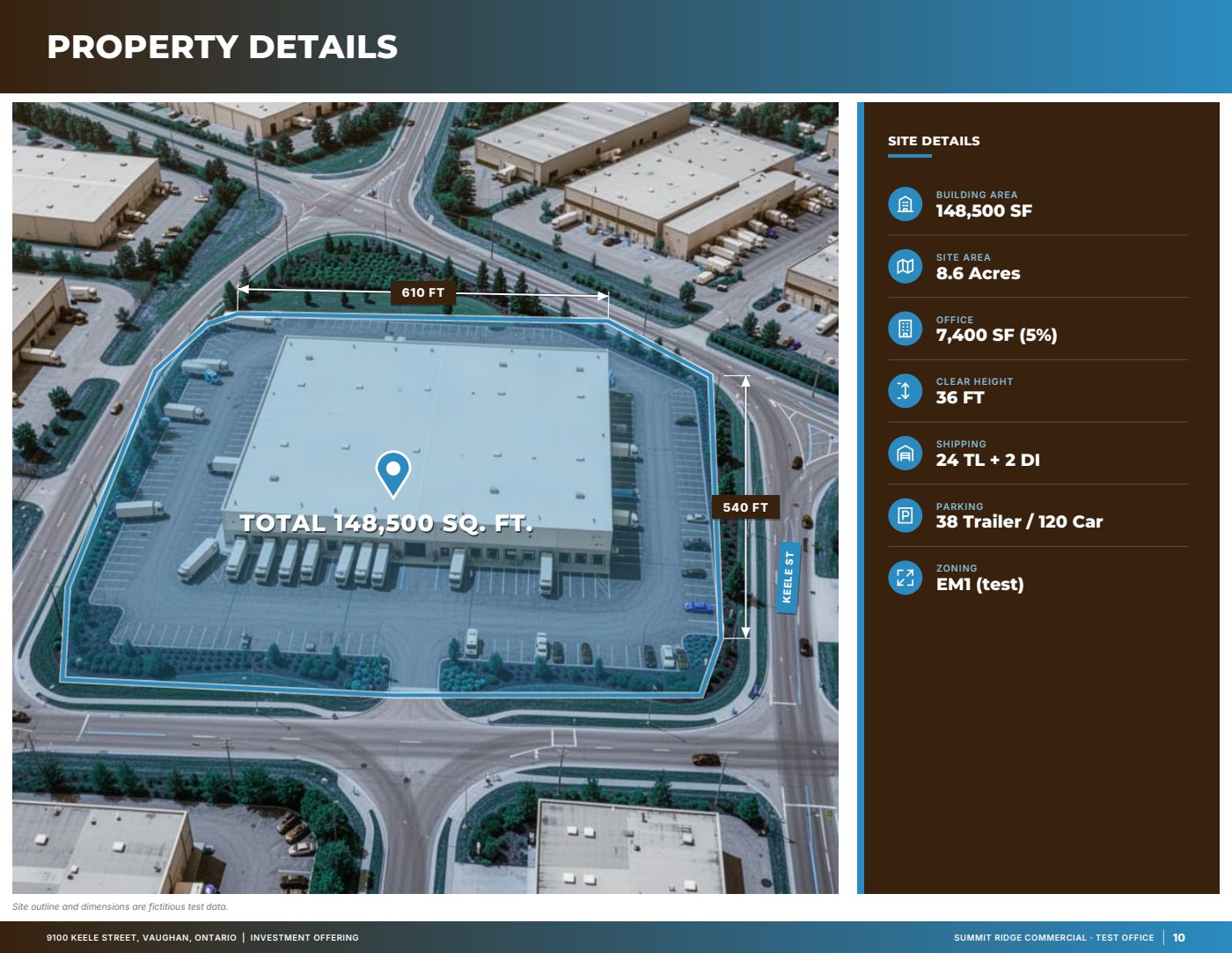
The first page after the cover is usually an aerial or oblique photo with the parcel outlined and the surroundings labelled. Done well, it answers half of a buyer’s questions at a glance.
- Outline the parcel boundary clearly and state the site area in acres and hectares.
- Label the nearest highways and interchanges, arterial roads and rail lines.
- Mark notable neighbours and landmarks, with leader lines rather than labels on top of buildings.
- Show which way is north, and date the imagery.
Keep a short narrative beside the aerial: what the site is, where it is, what it is zoned for and why it suits the likely buyer. Three or four sentences of specific facts beat a page of adjectives.
Site details
Give the physical facts in one consistent table so a buyer can copy them into their own model:
- Municipal address, legal description and PIN, where available.
- Site area (gross and, if relevant, net developable area after setbacks, easements or natural heritage features).
- Frontage and depth, and the roads the site fronts on.
- Shape and topography, if they affect what can be built.
- Existing structures, if any, and whether they are included.
- Asking price, price per acre, or the offering process.
If the developable area depends on a study or a planning approval that hasn’t happened yet, say so. A buyer will check, and a figure that turns out to be optimistic undermines the rest of the brochure.
Zoning and planning status
For land, zoning is the product. State the zone code and the by-law it comes from, the official plan designation, and the permitted uses that matter to the likely buyers: warehousing, manufacturing, outside storage, truck terminals, and any uses that are prohibited or need special permission.
Industrial zone codes such as M1 or M2 mean different things in different municipalities, so never rely on the code alone; quote the permitted uses from the by-law that applies and note the date you checked it.
Include the key performance standards if you have them: maximum lot coverage, maximum height, minimum setbacks and parking or loading requirements. If there is an approved or pending site plan, minor variance, consent or rezoning, describe its status and where the documents can be obtained.
Servicing
Servicing often decides the value of industrial land. A buyer needs to know what is available at the lot line and what would have to be extended or upgraded:
- Municipal water: availability and main size, where known.
- Sanitary sewer: availability, main size and any capacity constraints.
- Storm water: outlet, any stormwater management requirements.
- Hydro: available supply and the nearest infrastructure; heavy power users will ask early.
- Natural gas and telecommunications.
Name the source for each line, for example municipal servicing maps, the vendor or a consultant’s report, and say when it was confirmed. If servicing is not yet available, say what is planned and when, according to whom.
Connectivity and drive times
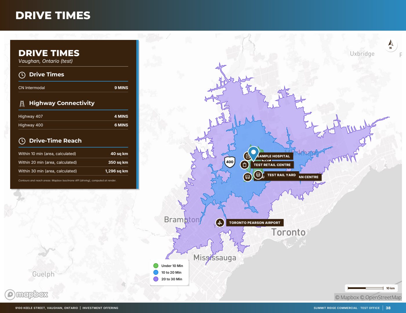
Logistics and manufacturing users choose sites by drive time. Show the drive-time areas (isochrones) for 10, 20 and 30 minutes, the distance and time to the nearest highway interchanges, and the major destinations a buyer will care about, such as intermodal terminals, airports, border crossings and the regional road network.
State how the drive times were calculated (for example, typical traffic on a routing service) and date them. If traffic counts are shown, give the counting programme, the year and whether they are annual averages or short counts.
Neighbours and the employment area
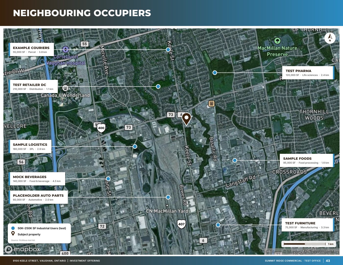
Who is nearby tells a buyer what the area is used for and how established it is. A map of neighbouring industrial occupiers, distribution centres and services, with names and leader lines, is more persuasive than a list. Only show businesses that are actually there today, and date the map.
If the site is in a designated employment area, say so and name the plan that designates it. That signals long-term protection for industrial use.
Labour and demographics
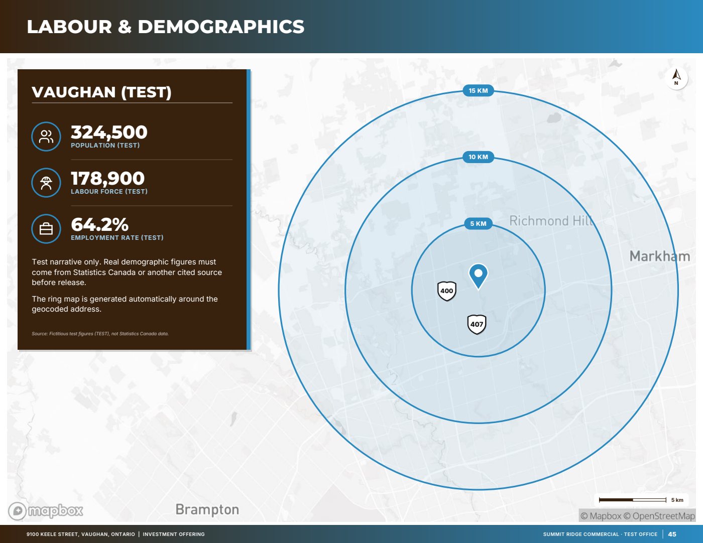
Industrial occupiers need workers. A labour page shows the population and labour force within a reasonable commute, usually a 30-minute drive, using official census figures with their source and year. Round down rather than up, and if a municipality is only partly inside the drive-time area, say so instead of apportioning the figure.
Photos, plans and the back cover
Even vacant land needs photos: the frontage from each road, the access points, any existing structures and the view across the site. Add the survey or a site sketch, and any concept plan the vendor is willing to share, clearly labelled as conceptual.
Finish with the listing team, the offering process (for example an offer date, or “offers considered as received”) and the next step for a buyer.
Common mistakes in land brochures
- Quoting a zone code without the permitted uses, so a buyer has to look up the by-law before they can tell whether their use is allowed.
- Calling a site “fully serviced” without saying which services are at the lot line and who confirmed it.
- Showing gross site area as if it were all developable when part of it is taken up by setbacks, easements, a watercourse or a road widening.
- Using an aerial that is several years old, so it shows neighbours that have moved or misses new buildings and roads.
- Listing every business within ten kilometres instead of the occupiers that tell a buyer something about the area.
- Mixing census figures from different years, or adding up whole municipalities that are only partly within the drive-time area.
- Presenting a concept plan as if it were approved.
Each of these is easy to avoid if the facts are gathered with their sources before the design work starts. A buyer’s consultants will check the zoning, servicing and site area early in due diligence, and a brochure that already matches what they find builds trust in the rest of the listing.
Industrial land brochure checklist
- Parcel outlined on a dated aerial, with north shown.
- Site area in acres and hectares; net developable area explained if shown.
- Zone code, by-law, official plan designation and the date checked.
- Permitted uses quoted, not paraphrased from the zone code.
- Each servicing line has a source and a date.
- Drive times dated, with the method stated.
- Neighbours map shows only current occupiers.
- Census figures carry their source and year; nothing apportioned.
- Concept plans labelled as conceptual.
- Approved disclaimer wording and a licensed professional’s review.
How OfferingStack helps
OfferingStack builds land brochures from the same property file as the teaser and the full OM. Start from an address or a fact sheet, and the land pages (zoning, servicing, connectivity, neighbours and labour) ask only for what they need. Location data is pulled with its source and date for you to check, calculated values are labelled, and a page with no data is left out rather than shown empty.
What these pages look like
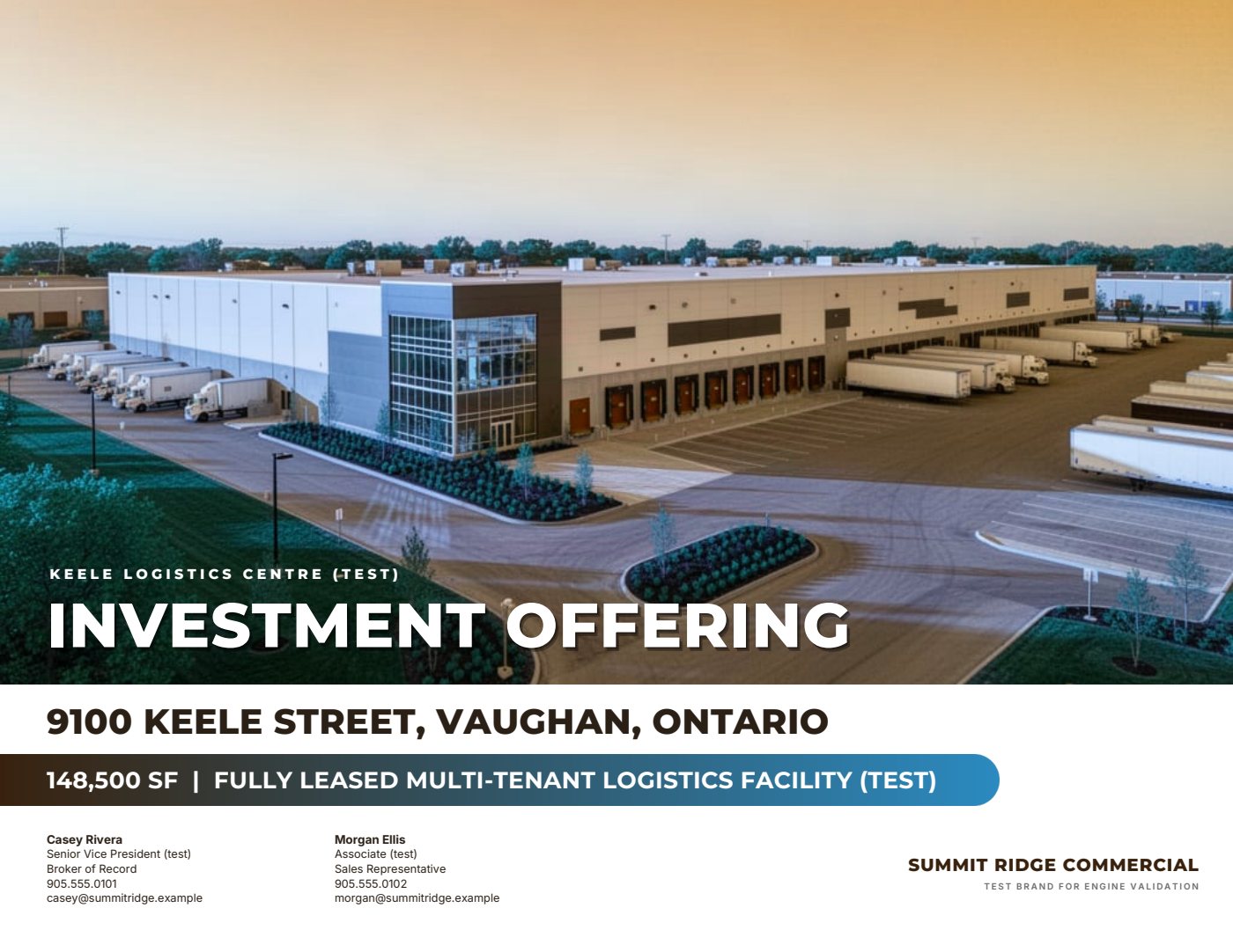
Sample pages are generated by the product from a fictitious test listing (9100 Keele Street, "Summit Ridge Commercial" test brand). Figures marked (test) are not real.
Related
Last updated 2026-10-14. General information for commercial real estate professionals, not legal advice.
Start with the fact sheet you already have.
Upload it, answer only what’s missing for the output you choose, and review a watermarked preview before you buy anything.